Morocco Physical Features:
Mountains, Rivers, Plains & Desert
An in-depth look at the natural geography that defines Morocco — from the snow-capped High Atlas to the dunes of the Sahara, and from fertile Atlantic lowlands to the rugged Mediterranean coastline.
The Morocco physical features are among the most varied of any country on the African continent. Covering approximately 446,300 km² in the northwestern corner of Africa, Morocco encompasses towering mountain chains, fertile Atlantic coastal lowlands, semi-arid interior plateaus, and vast Saharan expanses — all within one national territory. Whether you are planning a trip or studying North African geography, understanding Morocco’s physical features is the essential starting point for appreciating the country’s landscapes, climate, biodiversity, and regional contrasts.
Map data © OpenStreetMap contributors · CyclOSM terrain tiles · Scroll to zoom, drag to explore Morocco’s relief.
Geographic Location & Natural Boundaries
To fully appreciate the physical features of Morocco, it helps to start with understanding where Morocco is located. The country occupies the far northwest of Africa, bordered to the north by the Mediterranean Sea and the Strait of Gibraltar — only 13 kilometres wide at its narrowest — to the west by the Atlantic Ocean, to the east by Algeria (1,559 km of shared land border), and to the south by the Saharan Western territory.
Morocco’s dual oceanic frontage on both the Atlantic and the Mediterranean is geographically uncommon in North Africa and constitutes one of its most defining physical traits. According to the Haut-Commissariat au Plan (HCP), this position sustains an exceptional ecological diversity, with Morocco classified into multiple bioclimatic zones ranging from humid to hyper-arid — a direct consequence of its topographic and geographic variety.
Key fact: Morocco is one of only three countries in the world — alongside Spain and France — to have coastlines on both the Atlantic Ocean and the Mediterranean Sea, a rare physical distinction that directly shapes its climate, ecosystems, and human geography.
Mountain Ranges: The Atlasic System
The most prominent among Morocco’s physical features is its mountain system. Four major ranges — collectively called the Atlasic system — run roughly northeast-to-southwest and form Morocco’s structural backbone. They serve as climatic barriers, hydrological divides, and ecological boundaries, giving the country the highest mean elevation of any North African state.
| Range | Direction | Highest Peak | Elevation | Key Characteristics |
|---|---|---|---|---|
| High Atlas (Haut Atlas) | NE – SW | Jbel Toubkal | 4,167 m | Highest range in North Africa; ~740 km long; seasonal snowpack |
| Middle Atlas (Moyen Atlas) | NE – SW | Jbel Bou Naceur | 3,340 m | Morocco’s primary watershed; Atlas cedar forests; volcanic lakes |
| Anti-Atlas | NE – SW | Jbel Aklim | ~2,531 m | SW extension of the High Atlas; Pre-Cambrian granite outcrops |
| Rif Mountains | E – W | Jbel Tidirhine | 2,456 m | Mediterranean arc; steep cliffs; active seismic zone |
| Sources: Haut-Commissariat au Plan du Maroc (HCP) · Direction de la Météorologie Nationale · Encyclopædia Britannica | ||||
The High Atlas extends approximately 740 kilometres from the Atlantic coast near Agadir to the Algerian frontier. Its summit, Jbel Toubkal (4,167 m), is the highest point in North Africa. The range separates the Atlantic-facing lowlands from the pre-Saharan south and sustains permanent snowfields that feed Morocco’s most important rivers.
The Middle Atlas, branching northeastward from the High Atlas near Midelt, reaches 3,340 metres. Classified by the Agence du Bassin Hydraulique de Sebou as Morocco’s principal watershed, it feeds four major river systems: the Sebou, Bouregreg, Oum Er-Rbia, and Moulouya. Its forests of Atlas cedar (Cedrus atlantica) and volcanic lakes — some exceeding 65 metres in depth — are legally protected natural areas.
The Rif range follows the Mediterranean coast from Tangier to the Moulouya valley. Geologically young and composed of unstable Flysch formations, it drops sharply to the sea in cliffs and narrow coves. The Centre National pour la Recherche Scientifique et Technique (CNRST) confirms this range as Morocco’s most seismically active zone, as evidenced by the Al Hoceima earthquakes of 1994 and 2004.
“The Atlasic system represents one of the most significant intracontinental orogenic belts globally, recording multiple deformation phases from the Precambrian through to the Alpine orogeny — evidence of Morocco’s exceptionally complex geological history.”— International Atomic Energy Agency (IAEA) · Morocco Geological Setting
Atlantic Plains & Interior Plateaus
Between the Atlas ranges and the Atlantic coast lie Morocco’s most fertile and densely populated lowlands — a key component of the country’s physical geography. These alluvial plains are formed by sediments deposited by the Atlas river systems and enriched over millennia. They constitute the agricultural heartland of Morocco and are home to most of its urban centres. For a full overview of Moroccan cities shaped by this geography, see the list of cities in Morocco.
The principal plains include the Gharb Plain (Sebou basin, one of the Maghreb’s most productive agricultural areas), the Saïs Plain around Fès and Meknès, the Chaouïa, Doukkala and Abda plains stretching south of Casablanca, the Haouz Plain west of Marrakech irrigated by traditional khettara systems, and the Souss Plain near Agadir, famed for its citrus and horticultural exports. According to the Ministère de l’Agriculture, du Développement Rural et des Eaux et Forêts, these plains account for the vast majority of Morocco’s irrigated farmland.
East of the Atlas, the Eastern High Plateaus extend between 1,200 and 1,300 metres above sea level toward Algeria. Semi-arid in character, they support limited vegetation and sparse populations. The Moulouya basin cuts through this plateau system as a natural corridor connecting the Atlas interior to the Mediterranean coast.
Rivers & Hydrographic Network
The hydrographic network is one of the most significant Morocco physical features in a regional context. The Secrétariat d’État Chargé de l’Eau reports that Morocco has constructed over 140 large dams, giving the country one of the highest per-capita water-storage capacities on the African continent. The Middle Atlas functions as the national water tower, feeding four major river basins that drain westward toward the Atlantic.
- Drâa ~1,100 km Morocco’s longest river; intermittent lower course
- Oum Er-Rbia 555 km Middle Atlas source; Atlantic outlet
- Moulouya 520 km Only perennial river reaching the Mediterranean
- Sebou ~450 km Highest discharge; ~50% of national surface water
- Tensift ~270 km Drains the Haouz Plain; seasonal regime
- Bouregreg 240 km Estuary separates Rabat from Salé
The Sebou, estimated by the Agence du Bassin Hydraulique de Sebou to carry nearly 50% of Morocco’s total surface-water volume, is the most hydrologically significant river. In the Saharan southeast, the Ziz and Rheris rivers flow toward the interior, sustaining oasis chains before disappearing into the desert sands.
Saharan Margins & Pre-Saharan Zones
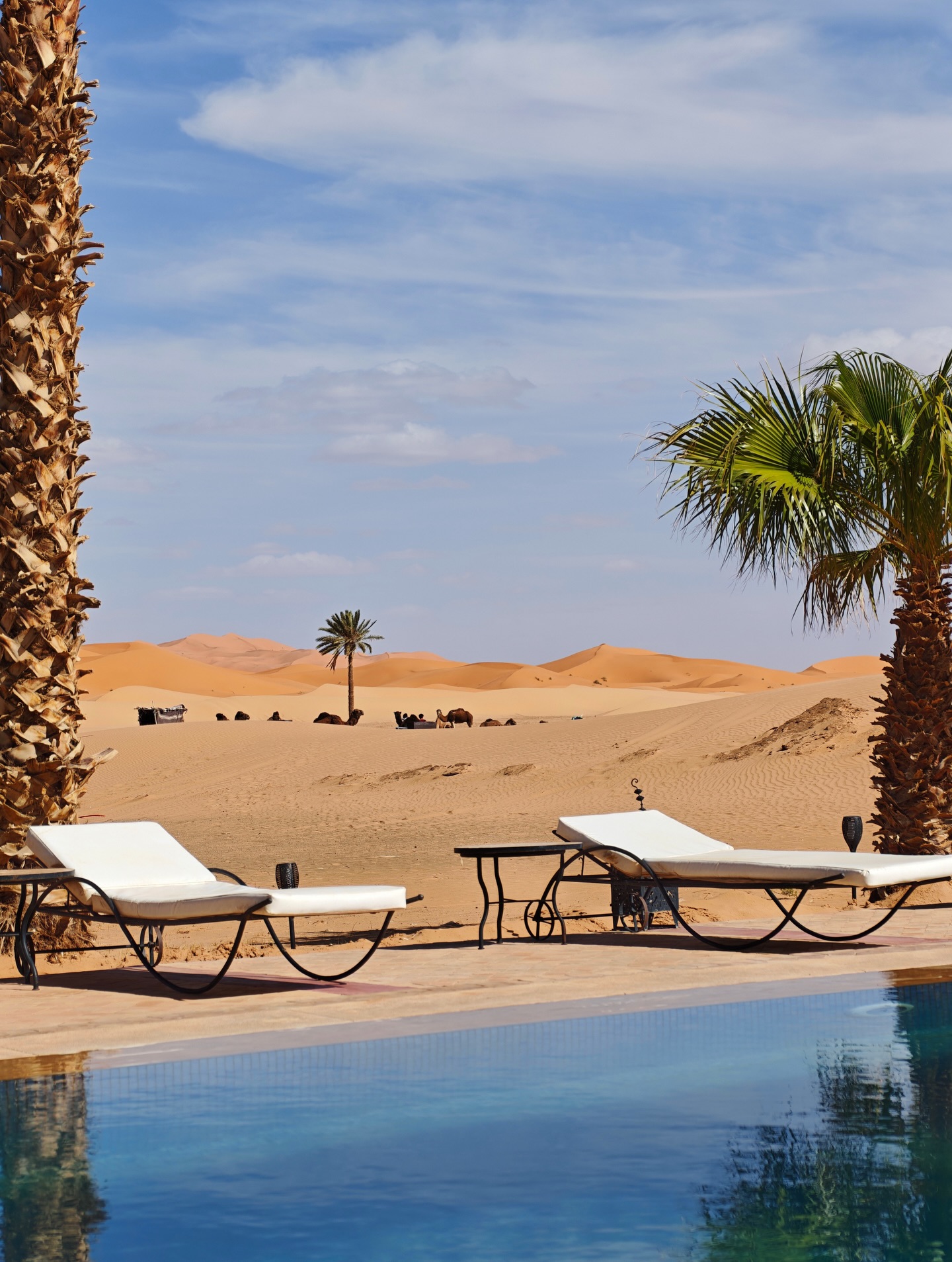
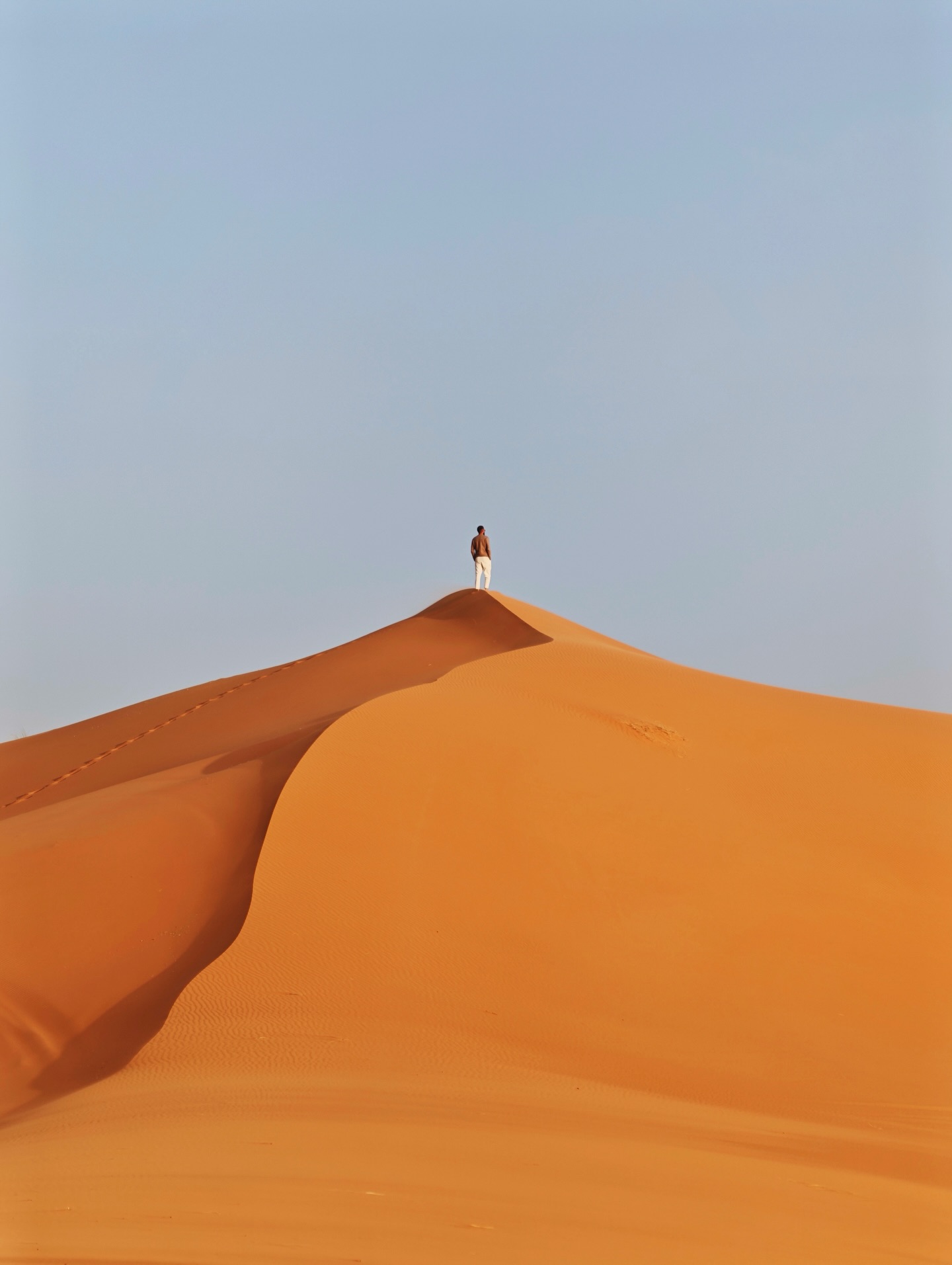
South and southeast of the Atlas, the terrain transitions through semi-arid scrubland and steppe into the northwestern edge of the Sahara — one of the most dramatic Morocco physical features and the one that most surprises first-time visitors. This compressed gradient from alpine peaks to desert dunes within a single country is geographically exceptional.
The Drâa Valley, running between the High Atlas and Anti-Atlas, is the main corridor into the pre-Saharan zone, lined with oases, ksour (fortified earthen villages), and palmeries representing some of Morocco’s oldest inhabited landscapes. The gorges of the Dadès and Todgha rivers cut vertically through limestone plateaus at the foot of the High Atlas — the Todgha gorge walls rise to approximately 160 metres, ranking among Morocco’s most spectacular geological formations.
True desert begins at Erg Chebbi near Merzouga, where sand dunes reach up to 150 metres. Morocco’s lowest point, the Sebkha Tah salt flat at −55 metres, lies in Tarfaya Province. The sub-soils of southern Morocco contain the world’s largest known phosphate reserves — estimated by the Office Chérifien des Phosphates (OCP) at over 50 billion tonnes.
Coastline: Two Contrasting Shores
Morocco’s 1,835-kilometre coastline is itself a composite of two contrasting physical environments and forms a defining element of the country’s physical features.
The Atlantic façade is generally regular and sandy, with low coastal cliffs alternating with wide beaches north of Casablanca. South of Agadir, the terrain grows increasingly arid as the Anti-Atlas foothills approach the sea, before flattening into the vast sandy Saharan coast. The Atlantic shore is shaped by the cold Canary Current, which generates marine upwelling zones of significant biological and economic importance — Morocco’s Atlantic fisheries are among the most productive in Africa, according to the Département de la Pêche Maritime.
The Mediterranean coast, from Tangier to the Moulouya estuary near Nador (approximately 512 km), is dominated by the abrupt descent of the Rif range to the sea, creating a striking alternation of rocky headlands, narrow coves, and steep cliffs. Two Spanish-administered enclaves — Ceuta and Melilla — are embedded in this coastline since the 15th century.
Climate Zones Shaped by Physical Geography
The physical features of Morocco — above all its mountain chains — act as major climate barriers, generating sharp contrasts between windward and leeward slopes and between the humid Atlantic north and the arid Saharan south. The Direction de la Météorologie Nationale (DMN) officially recognises five bioclimatic zones across the country. To understand how these zones affect travel conditions by season, see the guide to the Best Time to Visit Morocco.
Mediterranean Coastal
Mild, wet winters and dry, warm summers. Annual rainfall 300–800 mm. Covers most of the Atlantic seaboard and the Tangier-Tetouan-Al Hoceima region.
Mountain Highland
Cold winters with regular snowfall above 1,000 m. Ski resorts at Ifrane (Middle Atlas) and Oukaïmeden (High Atlas). Short, cool summers at altitude.
Semi-Arid Continental
High seasonal temperature range. Annual precipitation 100–350 mm, irregular. Covers the eastern plateaus and leeward Atlas slopes.
Arid & Saharan
Fewer than 100 mm of rain per year in pre-Saharan zones; near zero in the ergs. Summer temperatures exceed 45 °C in sheltered desert valleys.
According to the DMN, annual precipitation ranges from over 1,800 mm in the western Rif to under 50 mm in the Saharan south. Mean national temperatures have risen by approximately 0.2 °C per decade since the 1960s, placing increasing pressure on water resources — particularly in the semi-arid interior. Morocco’s National Climate Change Policy (2014) identifies water stress and desertification as primary risk factors directly linked to the country’s existing physical geography.
Frequently Asked Questions about Morocco Physical Features
The main Morocco physical features include four mountain ranges (High Atlas, Middle Atlas, Anti-Atlas, and Rif), extensive Atlantic coastal plains (Gharb, Haouz, Chaouïa, Souss), a network of rivers (Sebou, Oum Er-Rbia, Moulouya, Drâa), semi-arid eastern plateaus, pre-Saharan gorges and oasis valleys, and a 1,835-kilometre dual coastline on the Atlantic and Mediterranean.
The highest mountain in Morocco is Jbel Toubkal in the High Atlas, at 4,167 metres above sea level. It is also the highest peak in North Africa and is located approximately 60 km south of Marrakech. It is accessible for trekking year-round.
Yes. The southeastern margin of Morocco borders the Sahara Desert. The most visited area is Erg Chebbi near Merzouga, where dunes reach up to 150 metres. Other Saharan Morocco physical features include the Dadès and Todgha gorges, the Drâa and Ziz oasis valleys, and extensive rocky regs.
The Drâa is Morocco’s longest river at approximately 1,100 km. It originates in the High Atlas and flows southwestward through the Drâa Valley, though its lower course is intermittent and often disappears into the desert before reaching the Atlantic. The Sebou, while shorter, carries the highest water volume of any Moroccan river.
Morocco’s mountain ranges act as climate barriers, blocking Atlantic and Mediterranean moisture from reaching the interior and south. This creates four distinct climate zones — Mediterranean coastal, mountain highland, semi-arid continental, and Saharan — all directly shaped by the country’s physical geography. The High Atlas, in particular, is responsible for the sharp climatic contrast between the Atlantic west and the arid east.